AARON T. CVAR, Ph.D., P.E.

PROFESSIONAL REGISTRATION
Colorado Professional Engineer 
Wyoming Professional Engineer

EDUCATION
B.S., Civil Engineering, Colorado State University, 1996
M.S., Civil Engineering, Colorado State University, 1999 
Ph.D., Civil Engineering, Colorado State University, 2014

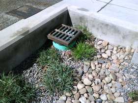
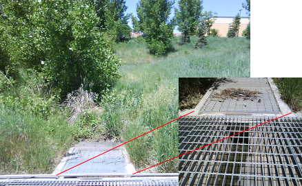
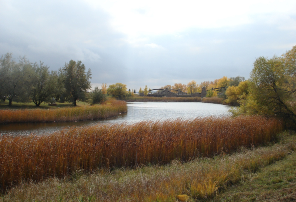
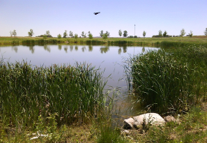
President/Owner (2008-present) – Front Range Stormwater & Floodplain Consulting, LLC, Fort Collins, Colorado. 
> Provided expert testimony and forensic engineering studies in support of water-related litigation 
> Conducted flood studies, and provided consultation regarding FEMA flood map interpretation, Letters of Map Revision (LOMR) 
> Provided consulting involving storm water management plans (SWMP) and storm drainage plans, reports, and design
> Designed irrigation systems, irrigation ponds, and flow measurement structures
> Applied Geographic Information Systems to numerous hydrologic studies 

Project Engineer (1999-2004), Senior Engineer (2004-2008) – Northern Engineering Services, Inc., Fort Collins, Colorado. 
> Managed teams of engineers and production staff, provided mentoring and guidance
> Successfully managed project budgets and schedules 
> Provided expert testimony and forensic engineering studies in support of water-related litigation 
> Conducted numerous master drainage studies and stormwater plans for residential, commercial, and municipal projects. 
> Worked comprehensively with FEMA’s National Flood Insurance Program on interpretation of flood mapping and application of FEMA Regulations 
> Prepared numerous floodplain analyses and studies according to FEMA guidelines
> Managed land development projects-ensured quality design and drafting of grading plans, pipelines, and basic infrastructure 
> Observed construction of pipelines, detention ponds, stormwater channels and provided post-construction certification 
> Incorporated sustainability, Best Management Practices (BMPs), Low Impact Design (LID) into the design of numerous detention and water quality ponds, open channels, and general drainage designs

Associate Water Resource Engineer (1998-1999) – Ballofet and Associates, Inc., Fort Collins, Colorado.
> Assisted with Research and formulation of water supply master plan studies
> Designed detention and water quality ponds, drainage channels, and storm sewer systems
>Drafted construction drawings for drainage infrastructure

Development Review Engineer (1997-1998) – City of Fort Collins Stormwater Utility, Fort Collins, Colorado.
> Reviewed stormwater quality and erosion control plans, drainage plans, and drainage reports for compliance with City drainage criteria 
> Approved post-construction drainage certifications for detention ponds, water quality ponds, open channels, and other drainage infrastructure  > Inspected construction sites to ensure proper best management practices and erosion control measures were in place and functional
> Communicated verbally and in writing with design consultants and contractors on design issues, code and criteria violations Engineering Intern (summer 1996) – Northstar Engineering and Surveying, Inc., Pueblo, Colorado.
> Designed detention ponds, small open channels and storm line systems
> Drafted drafted plans in AutoCad for stormwater infrastructure and general construction details  
> Worked portion of summer with survey crew and experienced general survey work with Total Station survey equipment

SELECTED PROJECT EXPERIENCE

STORMWATER ANALYSIS/DESIGN
East I-25 Basin Drainage Master Plan, Loveland, Colorado – 1.5 square mile master drainage study

South Gateway Master Drainage Study, Laramie, Wyoming – 300 ac. stormwater modeling study  

Master Drainage Study for Highland Meadows Golf Course Subdivision, Windsor, Colorado – 640 ac. master drainage study 

Master Drainage Study for Timnath Ranch Third Filing, Timnath, Colorado – 600 ac. master drainage study 

Master Drainage Study for Timnath South Subdivision, Timnath, Colorado – 370 ac. master drainage study 

Master Drainage Study for Wellington East, Wellington, Colorado – 300 ac. master drainage study 

Storm Drainage Design for Timnath Ranch Third Filing, Timnath, Colorado – 
600 ac. site drainage infrastructure design (commercial and residential mix)

Storm Drainage Design for Timnath South Subdivision, Timnath, Colorado – 
370 ac. site drainage infrastructure design (residential)

Storm Drainage Design for Centerra East, Loveland, Colorado
 – 300 ac. site drainage infrastructure design (commercial)

Storm Drainage Design for Windshire Park, Windsor, Colorado – 200 ac. site drainage infrastructure design (residential)

Storm Water Management Plan (SWMP) – Centerra Parkway Expansion, Loveland, Colorado – Formulated SWMP for half-mile roadway expansion 

Storm Water Management Plan (SWMP) – Centerra East Drainage Infrastructure, Loveland, Colorado 
– Formulated SWMP for construction of drainage infrastructure for 300 ac. commercial site

Storm Water Management Plan (SWMP) – Hageman Earth Cycle, Fort Collins, Colorado – Formulated SWMP for commercial site handling recycling of yard waste and landscaping materials 

Storm Water Management Plan (SWMP) – AFCO Steel Plant, Greeley, Colorado – Formulated SWMP for industrial site handling and storing steel products

Storm Water Management Plan (SWMP) – Ranch-Way Feeds, Fort Collins, Colorado – Formulated SWMP for commercial site handling and storing agricultural feed products 

FLOODPLAIN ANALYSIS/STUDIES

Letter of Map Revision (LOMR) for Interchange Business Park, Fort Collins, Colorado – Half-mile FEMA jurisdictional floodplain map revision 

Conditional Letter of Map Revision (CLOMR) for Block One Commercial Development, Fort Collins, Colorado – FEMA jurisdictional floodplain map revision including re-work of effective HEC-2 modeling of Cache La Poudre River

Letter of Map Revision (LOMR) for The Town of Severance, Severance, Colorado
 – 1.5-mile FEMA jurisdictional floodplain map revision

Letter of Map Amendment (LOMA) for Timnath Ranch Third Filing, Timnath, Colorado
 – One-mile FEMA jurisdictional floodplain map amendment 

Letter of Map Revision (LOMR) for Lee MLD, Fort Collins, Colorado
 –Quarter-mile FEMA jurisdictional floodplain and floodway map revision
Letter of Map Revision Based on Fill (LOMR-F) for Wellington Downs, Wellington, Colorado – 15 ac. multi-lot LOMR-F to remove lots from FEMA jurisdictional floodplain

Letter of Map Revision Based on Fill (LOMR-F) for Poudre Heights, Windsor, Colorado – 
10 ac. multi-lot LOMR-F to remove lots from FEMA jurisdictional floodplain

Letter of Map Revision Based on Fill (LOMR-F) for Soth residence, Larimer County, Colorado – single lot LOMR-F and accompanying flood hydrology and hydraulic study to remove residence from FEMA jurisdictional floodplain

Flood Study for Mountain Greenery Resort, Larimer County, Colorado – Quarter-mile flood hydrology and hydraulic study under Larimer County jurisdiction

Approximate Zone A Flood Study for Androvich Property, Weld County, Colorado – Flood hydrology and hydraulic study under Weld County jurisdiction to establish 100-year peak discharge rate and Base Flood Elevations

Approximate Zone A Flood Study for Hammond Property, Larimer County, Colorado – Flood hydrology and hydraulic study under Larimer County jurisdiction to establish 100-year peak discharge rate and Base Flood Elevations and floodway 

Breach Analysis and Inundation Study for John Law Reservoir, Severance, Colorado –
 Modeled dam breach scenario for irrigation reservoir, and resulting flood wave inundation through multiple downstream proposed and existing residential subdivisions. 

Breach Analysis and Inundation Study for Bayfield Water Treatment Plant, Bayfield, Colorado – 
Modeled dam breach scenario for water treatment plant reservoir, and resulting flood wave inundation through existing residential and commercial areas. 

Relocation of McClellands Creek Channel, Fort Collins, Colorado – Quarter-mile floodplain channelization study and design under City of Fort Collins jurisdiction

EXPERT WITNESS/LITIGATION SUPPORT

Expert Testimony – Schiller Case, Logan County, Colorado – Provided expert testimony and forensic engineering study for litigation involving flooding of farm  

Expert Testimony – Wall Case, Weld County, Colorado – Provided expert testimony and forensic engineering study for litigation involving flooding of residence  

Forensic Engineering Study – Foothills Estates Subdivision, Larimer County, Colorado – 
Provided forensic engineering study for litigation involving subdivision flooding

Forensic Engineering Study – Coyote Ranch Apartments, Denver, Colorado
 –Provided forensic engineering study for litigation involving apartment complex flooding

Forensic Engineering Study – Ace Hardware of Wellington, Wellington, Colorado
 – Provided forensic engineering study for litigation involving flooding of business

DRAINAGE MITIGATION STUDIES

Drainage Mitigation Study – Stadium Village Apartments, Fort Collins, Colorado – Conducted mitigation study for appartment complex flooding

Drainage Mitigation Study – Villas at Ptarmigan, Windsor, Colorado – 
Conducted mitigation study and designed solutions for subdivision drainage problemsDrainage Mitigation Design – Wall Residence, Weld County, Colorado- Provided design construction plans for pump system to mitigate flooding 

Drainage Mitigation Design – Harmony Crossing Subdivision, Fort Collins, Colorado – Provided design construction plans for mitigation of failing detention pond outlet structure


Water Quality Enhancement and Bioretention

Bioretention Cell

Bioretention cells are also commonly referred to as  “Rain Gardens”.  Porous Landscape Detention (PLD) is also a type of bioretention.  Bioretention is typically utilized in more intensely developed areas  – commercial, multi-family developments, etc.  Often, bioretention cells are designed for confined spaces such as: 

  • Parking lot islands
  • Street medians
  • Landscaped areas between drives, parking areas, roads and sidewalks, etc.
  • Planter boxes collecting roof drains, street drains, etc.

Bioretention works to enhance infiltration, and to provide some water quality capture volume (holding volume for settling of suspended solids).  Bioretention cells can also act as a “filter” for storm runoff.  The growing media in a bioretention cell can trap sediment and pollutants.  Additionally, biological uptake can occur in bioretention cells, which enhances the removal of pollutants within storm runoff.

The soil mixture/growing media is critical for a bioretention cell. See recommendations on soil mixtures in the Urban Storm Drainage Criteria Manual  (USDCM) Volume 3, by the Urban Drainage and Flood Control District, December 2010.

Urban Drainage and Flood Control District website 

It is critical that bioretention cells be protected during the construction process from sources of sediment.  In typical construction, large areas of land can be left exposed to erosion.  If a bioretention cell is downstream of areas of exposed/unvegetated land, there is potential for large volumes of sediment to be discharged into the cell during a storm event.  This could result irreparable damage to the growing media of the cell.

Care needs to be taken when bioretention cells are placed near the foundations of structures, roadways, etc.  Often, bioretention cells are designed as a focal point for surrounding drainage.  Saturation of the underlying soil  in the vicinity of a bioretention cell can occur, adversely impacting foundations, the stability of roadways, etc.  Again, recommendations in the Urban Storm Drainage Criteria Manual  (USDCM) Volume 3, by the Urban Drainage and Flood Control District, December 2010, should be consulted.

Photos: A. Cvar

Water Quality Enhancement and Extended Detention

Extended Detention is probably one of the most effective green stormwater practices, and is also one of the most practical means of achieving stormwater sustainability goals.

Extended Detention has been shown to have a very high total suspended solid (TSS) removal rate. Extended detention can often be incorporated into the lower stage of detention ponds, and is therefore very practical to implement.  Typically, Extended Detention volume is roughly 5% to 10% of required detention volume.  Adding an Extended Detention component to a detention pond is typically not a significant encumbrance.

The release structure for an Extended Detention Basin consists of a water quality orifice plate which is designed to slowly release the stormwater holding volume (commonly referrred to as “water quality capture volume”) over a certain period of time.  Typically this period of time is around 40-hours, but can vary with municipalities and different drainage design criteria.

How Does Extended Detention Work? 

Stormwater can hold a number of pollutants:

  • Solids
  • Nutrients
  • Pathogens
  • Suspended Solids
  • Trash 
  • Metals
  • Oils

Extended Detention allows for settling of suspended solids.  Many pollutants bind to suspended solids, and by removing these solids, we can enhance stormwater quality.

Extended Detention Basins act as stormwater settling ponds.  Storm runoff enters the pond, is held for a certain time period, and is released very slowly over a specified holding period.  This holding period allows for solids suspended within the storm runoff to “fall out” of turbid stormwater.

Smaller, more frequent storms are the predominant factor in stormwater pollutant loading.  The Extended Detention Basin’s holding volume is intended to capture runoff from the average storm event.  Typically, Extended Detention Basins are designed to capture runoff from the average storm (approximately a 1-year runoff event) and release over a 40-hour period. Again, this time period can vary with municipalities and drainage criteria.

Photos: A. Cvar

An Introduction to Stormwater Sustainability and Green Practices

There are many ideas revolving around sustainability, and it can be hard to narrow in on a singular definition.  Many municipalities are trying to become more sustainable in their operations, and promote sustainability among their citizens.

How does sustainability and green practices relate to stormwater?

When you think of true stormwater sustainability, you think of what happens in nature.  Nature has it’s own way of:

  • Reducing runoff volumes by infiltration
  • Reducing soil loss through vegetation
  • Reducing pollutants in storm runoff by infiltration and biological uptake

What are we trying to achieve with stormwater sustainability?

Nature is a good example to follow as it works to reduce runoff volumes by infiltration, reduce soil loss through vegetation, enhance habitat,  and reduce pollutants in storm runoff by infiltration and biological uptake.

When we develop land, we change the natural system. Often, we increase both the peak runoff rate (typically measured in cubic feet per second, CFS) as well as the volume of runoff (typically measured in cubic feet or acre feet).  The increase in both developed runoff rate and volume can be harmful to downstream channels, resulting in degradation.  This degradation has effects on habitat as well as water quality by increasing sediment loads.

In addition to increasing runoff, we also introduce new sediment loads and pollutants into the natural system through the development process.  During construction, we can introduce new sediment loads by exposing previously vegetated soil.  After development is completed, we often see a whole new set of pollutants in storm runoff.

The primary objectives of stormwater sustainability are to mitigate these changes to the natural system.  
We can do this by:

  1. Incorporating Construction BMP’s
  2. Encouraging Stormwater Infiltration
  3. Incorporating Stormwater Infiltration
  4. Implementing Stormwater Settling Basins

1—Incorporate Contruction BMP’s

BMPs during construction should be implemented to reduce erosion, capture sediment, and contain hazardous materials. 

Reduce  erosion:  Keep soil in place, treat soil as a resource.

Capture sediment:  Some erosion will occur regardless of how good your erosion reduction measures are.  The resulting sediment should be prevented from leaving the construction site.

Material containment:  Measures should be implemented to avoid contamination of stormwater and downstream receiving waters through the leakage of hazardous materials.

2–Encourage Stormwater Infiltration

Increases in both runoff rate and volume resulting from land development can be harmful to downstream systems.  By encouraging infiltration, we are seeking to mitigate the effects of land development.

Porous paver systems, for example, as seen in the picture to the right, can be utilized to enhance stormwater infiltration. In a porous paver system, the gaps between the pavers allow runoff to pass through to a gravel bed underneath the paver surface.  Stormwater accumulates in this bed, and is allowed to slowly infiltrate into the underlying soil.

Infiltration can also improve water quality through filtration and biological uptake which occur during the infiltration process.

3—Incorporate Stormwater Filtration

Developed runoff can contain a number of pollutants such as suspended solids, trash, and oils.  Filtration can be an effective means at removal of such pollutants.

Filtration can be designed in the form of rain gardens, like the one on the left; sand filtration beds; grass buffer strips; to list a few.  Filtration systems can be installed within storm pipe systems as well.  There are a variety of products available to capture solids and oils within storm manholes.

4—Implement Stormwater Settling Basins

Many of the pollutants in stormwater bind to suspended solids/sediment.  By removing suspended solids, we can also reduce pollutants in stormwater.  Additionally, removing suspended solids helps downstream channels and receiving waters by reducing sediment loading.

By incorporating stormwater settling basins, we can significantly reduce suspended solids carried by stormwater.  Settling basins are also referred to as “Extended Detention” basins.  “Water Quality Capture Volume” refers to the volume that a settling basin/extended detention basin is sized to hold.

A common design standard is to capture a certain amount of stormwater runoff (roughly the volume of a 1-year storm event) and release the water slowly over a 40-hour period.  This holding period allows for the settling of suspended solids in turbid stormwater.

Photos: A. Cvar

Integrating Sustainability with Detention Facilities

Sustainable practices such as extended detention, flat grading of pond bottom, micropools, and trickle channels can often be incorporated into the lower stage of detention ponds.

Extended Detention is probably one of the most effective green stormwater practices, and is also one of the most practical means of achieving stormwater sustainability goals.

Extended Detention has been shown to have a very high total suspended solid (TSS) removal rate. Extended detention can often be incorporated into the lower stage of detention ponds, and is therefore very practical to implement.  Typically, Extended Detention volume is roughly 5% to 10% of required detention volume.  Adding an Extended Detention component to a detention pond is typically not a significant encumbrance.


Extended Detention/Flat Bottom Pond Integrated with Detention 
Flat bottom ponds with appropriate landscaping can enhance infiltration and water quality.

Micropool and Tricle Channel Integrated with Detention Facility
Manicured, sloped turf can be integrated with a fairly flat trickle channel and micropool to create a very aesthetically pleasing design that contributes to water quality enhancement.

One of the main challenges with integration of extended detention with detention is pond maintenance and outlet clogging.

An important question is, how will the pond be landscaped?  Do you expect a high volume of vegetation that can clog outlets?

In the picture to the left, a standard extended detention water quality pond was designed in an area with very dense landscaping.  The maintenance crew complained of the outlet constantly clogging, and eventually removed the water quality plate.

Many of the trash screens used  for the water quality component will clog even with the smallest of debris.  A standard trash screen is shown in the picture to the right.  The trash screen is positioned in between the trash rack and the water quality plate, which has a series of circular holes intended to control the release of water from the pond.

Clogged outlets lead to standing water, which leads to issues with mosquitos as well as other health concerns.

Photos: A. Cvar

An Overview of Wet and Dry Detention Facilities

A detention pond acts, in essence, as a temporary holding pond which decreases the impact of stormwater runoff in downstream drainage channels, pipes, etc.  Similar to how beaver dams act in nature, detention ponds serve to soften the impact of surges in storm runoff by holding a certain volume of storm runoff, and releasing the runoff at a decreased rate.

Depending on the municipality, detention ponds are required to hold different volumes of storm runoff. Often, detention ponds are required to hold up to a 100-year storm volume, and release at a 2-year or 10-year historic rate of flow.

Many detention ponds have “staged” outlet structures.  What this means is that the pond has been designed to release different flow rates at different stages of the pond’s operation.  A detention pond may be designed to release a very low flow rate in a 2-year storm event, but release much more in a 100-year storm. 

 Such a pond would have a “2-stage” outlet structure.  For the first stage, the structure would release up to a certain flow rate at up to the 2-year storm volume.  For the second stage, the structure would release up to a certain flow rate at up to the 100-year storm volume.

Whether a detention pond is “wet” or “dry” it performs the same function from a stormwater perspective.  In both cases the pond serves as a stormwater facility functioning to capture a specified volume of storm runoff and release stormwater flows at a reduced rate.  Detention, whether in the form of a wet or dry facility, serves to decrease the impact of stormwater runoff by decreasing the peak flow rate.

Wet ponds can add tremendous aesthetic value to a project. When we talk about a “wet” pond, we are typically referring to a detention pond that functions also as a holding pond.  Stormwater can be detained on top of the permanent storage volume.  The storage volume may be there for practical reasons such as holding a certain amount of irrigation water, or simply for aesthetic purposes.

Some considerations with wet detention ponds:

>Safety – Dry detention ponds only hold water for a limited amount of time; wet ponds pose a continual safety concern 
>Permitting Requirements – the State or other agencies will likely require a permitting process to be undergone for a wet pond 
>Groundwater levels and construction de-watering 
>Types of liner 
>Control of water level 
>Pond depth as it relates to maintaining water quality

Photos: A. Cvar

Runoff Reduction and Porous Pavers

When we develop land, we change the natural system. Often times, we increase both the peak runoff rate as well as the volume of runoff.  The increase in both developed runoff rate and volume can be harmful to downstream channels, resulting in degradation.  This degradation has effects on habitat as well as water quality by increasing sediment loads.

Detention Ponds are not typically designed to reduce the volume of storm runoff (typically measured in cubic feet or acre feet); rather, their intent is to reduce the runoff rate (typically measured in cubic feet per second, CFS).

In order to reduce the volume of storm runoff, it is necessary to implement design features which enhance infiltration.

A good example of a design feature that enhances infiltration is the porous paver system.   Porous pavers work to enhance stormwater infiltration.

Modular block pavers are one example of a porous paver product.  These are designed to create spaces through which water can infiltrate into an underlying gravel layer.

Runoff is  stored in this underlying gravel layer and allowed to slowly infiltrate into the soil below. Seeing the installation steps for a porous paver system can be illustrative. 

The installation steps for a porous paver system are outlined below.

Step 1-Subgrade Preparation

Subgrade is exposed and leveled in preparation for the application of the first layer of gravel.

Step 2—First Layer of Gravel Applied

The first layer of gravel, typically referred to as the “base course” is applied.  The thickness of this layer varies, with the intent being to provide a certain amount of holding volume for storm runoff.  Runoff will fill the voids of the gravel and slowly infiltrate into the underlying subgrade.

The black fabric seen in the picture is a geotextile filter fabric, intended to prevent the intermingling of the gravel and the underlying soil.

 Step 3—First Layer of Gravel Leveled 

The first layer of gravel is roughly leveled in preparation for the second layer of gravel.

Step 4—Second Layer of Gravel Applied 

The second layer of gravel, typically referred to as the “leveling course” is applied, and leveled.

Step 5 —Sand Layer Applied and Pavers Laid in Place

In some cases, a layer of sand is applied to further enhance leveling. Once final leveling is completed, the pavers are laid in place. Depending on the paver product, sand is sometimes swept over the top of the finished surface to fill the gaps between the pavers.

Finished Product! 

At the end of the process, we have an attractive and durable surface that is capable of allowing stormwater runoff to infiltrate to the soil below.

Photos: A. Cvar